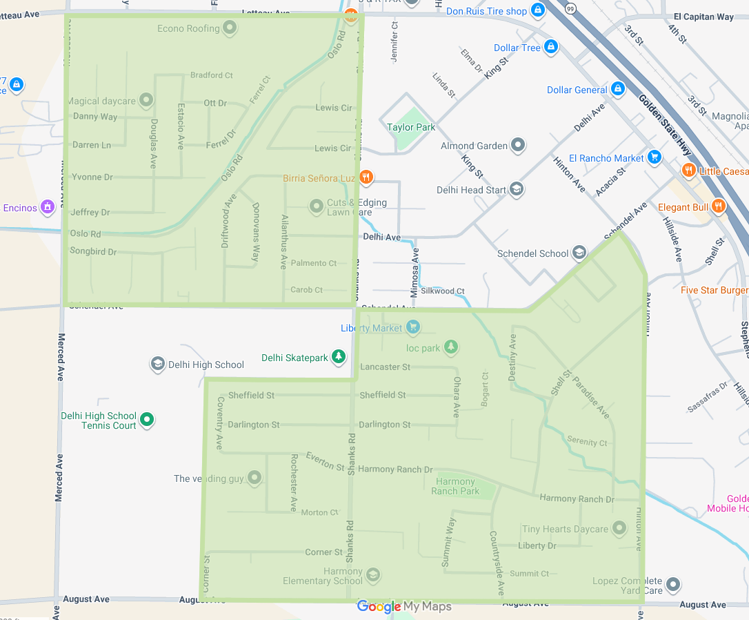
Treatment History
5/15/26, Delhi "Danelle Ct Neighborhood" and "Ohara Ave Neighborhood"
| Date | Time | Treatment Type | Material | Status |
|---|---|---|---|---|
| 5/15/26 | 3:30am-5:30am | Ground Larviciding | Altosid SR20 | Complete |
Area:
Delhi- Danelle Ct neighborhood and Ohara Ave neighborhood
Map:
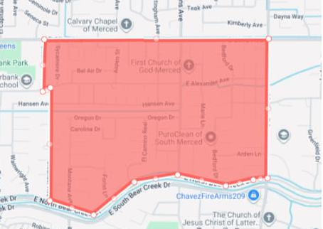
5/14/26, Merced "Bedford Neighborhood"
| Date | Time | Treatment Type | Material | Status |
|---|---|---|---|---|
| 5/14/26 | 3:30am-5:30am | Ground Larviciding | Altosid SR20 | Complete |
Area:
Merced – Area north of Bear Creek, south of Olive, west of Mckee, east of Oleander
Map:
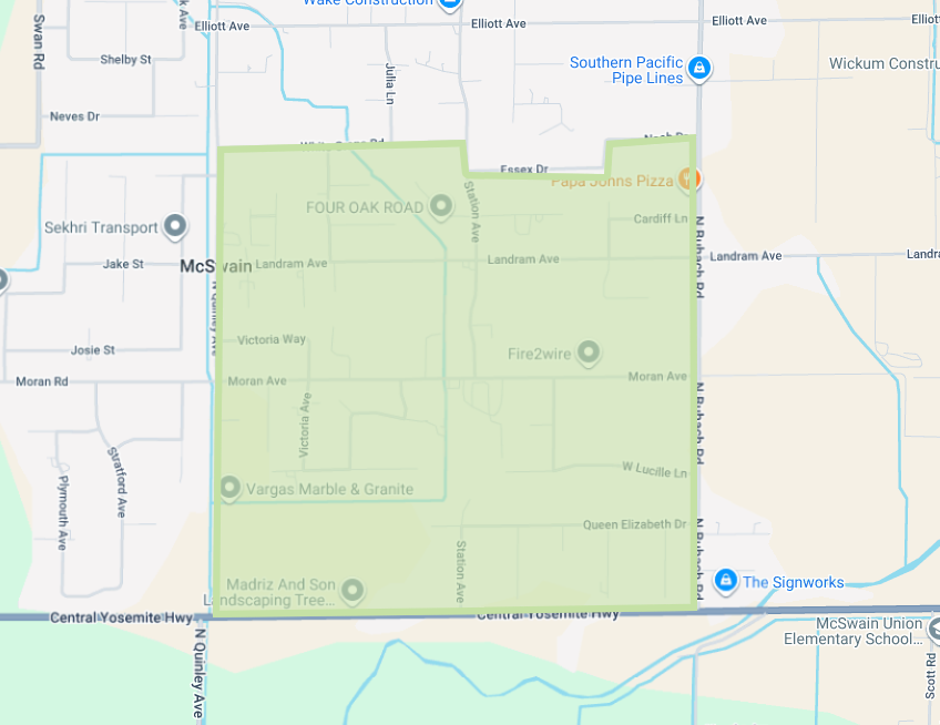
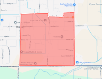
5/13/26, Atwater "McSwain Neighborhood"
| Date | Time | Treatment Type | Material | Status |
|---|---|---|---|---|
| 5/13/26 | 3:30am-5:30am | Ground Larviciding | Altosid SR20 | Complete |
Area:
Atwater- McSwain neighborhood
Map:
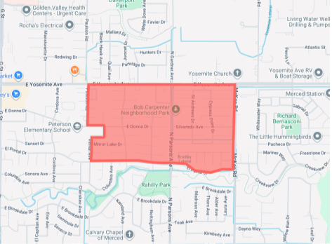
5/12/26, Merced "El Redondo Neighborhood"
| Date | Time | Treatment Type | Material | Status |
|---|---|---|---|---|
| 5/12/26 | 3:30am-5:30am | Ground Larviciding | Altosid SR20 | Complete |
Area:
Merced – Area north of Buena Vista, south of Yosemite, east of HWY 59, and west of Mckee
Map:

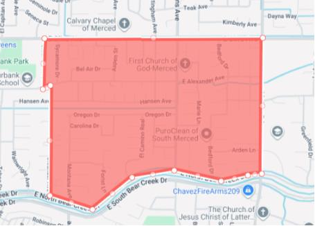
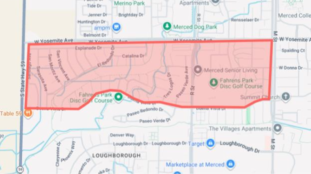
5/8/26, Merced "Bedford Neighborhood"
| Date: | Time: | Treatment Type: | Material: | Status: |
|---|---|---|---|---|
| 5/8/26 | 3:30am-5:30am | Ground Larviciding | Altosid SR20 | Complete |
Area:
Merced – Area north of Bear Creek, south of Olive, west of Mckee, east of Oleander
Map:
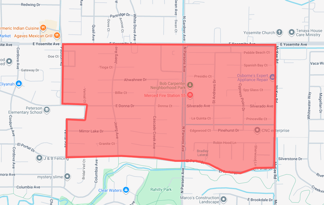
5/7/26, Merced "Joerg Neighborhood"
| Date: | Time: | Treatment Type | Material | Status |
|---|---|---|---|---|
| 5/7/26 | 3:30am-5:30am | Ground Larviciding | Altosid SR20 | Complete |
Area:
Merced- Area north of El Portal, south of Yosemite, east of Paulson, and west of Mckee
Map:
5/6/26, Atwater "McSwain Neighborhood"
| Date | Time | Treatment Type | Material | Status |
|---|---|---|---|---|
| 5/6/26 | 3:30am-5:30am | Ground Larviciding | Altosid SR20 | Complete |
Area:
McSwain
Map:
5/5/26, Merced "El Redondo Neighborhood"
| Date | Time | Treatment Type | Material | Status |
|---|---|---|---|---|
| 5/5/26 | 3:30am-5:30am | Ground Larviciding | Altosid SR20 | Complete |
Area:
Merced – Area north of Buena Vista, south of Yosemite, east of HWY 59, and west of Mckee
Map:
4/30/26, Merced "Bedford Neighborhood"
| Date | Time | Treatment Type | Material | Status |
|---|---|---|---|---|
| 4/30/26 | 3:30am-5:30am | Ground Larviciding | Altosid SR20 | Complete |
Area:
Merced- Area north of Bear Creek, south of Olive, west of Mckee, east of Oleander
Map:
4/29/26, Merced "Joerg Neighborhood"
| Date | Time | Treatment Type | Material | Status |
|---|---|---|---|---|
| 4/29/26 | 3:30am-5:30am | Ground Larviciding | Altosid SR20 | Complete |
Area:
Merced – Area north of El Portal, south of Yosemite, east of Paulson, and west of Mckee
Map:
4/28/26, Atwater "McSwain Neighborhood"
| Date | Time | Treatment Type | Material | Status |
|---|---|---|---|---|
| 4/28/26 | 3:30am-5:30am | Ground Larviciding | Altosid SR20 | Complete |
Area:
Atwater- McSwain Neighborhood
Map:

4/27/26, Merced "El Redondo Neighborhood"
| Date | Time | Treatment Type | Material | Status |
|---|---|---|---|---|
| 4/27/26 | 3:30am-5:30am | Ground Larviciding | Altosid SR20 | Complete |
Area:
Merced – Area north of Buena Vista, south of Yosemite, east of HWY 59, and west of Mckee
Map:
4/24/26, Merced "Joerg Neighborhood"
| Date | Time | Treatment Type | Material | Status |
|---|---|---|---|---|
| 4/24/26 | 3:30am-5:30am | Ground Larviciding | Altosid SR20 | Complete |
Area:
Merced- Area north of El Portal, south of Yosemite, east of Paulson, and west of Mckee
Map:
